| 008-013-040 & 008-013-041 |
|---|
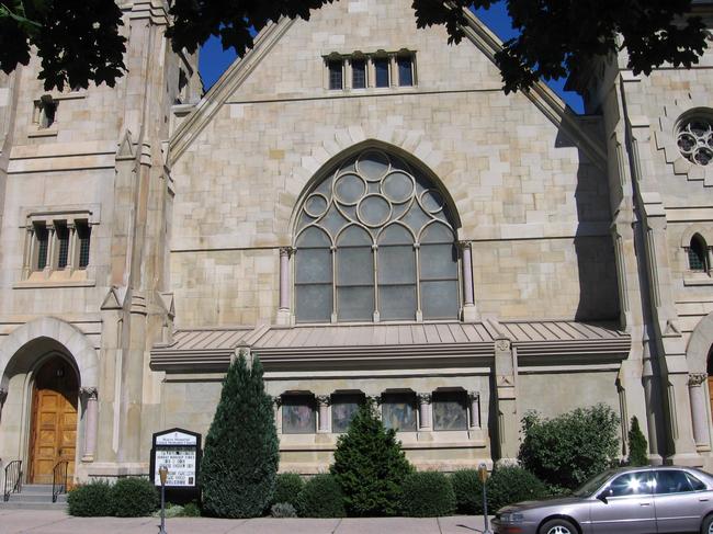
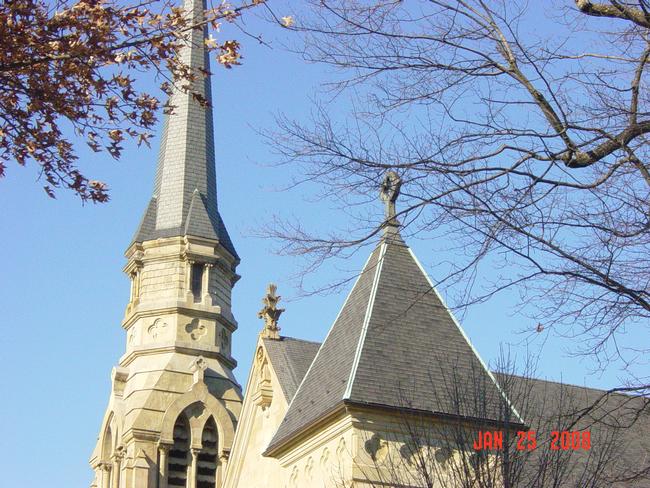
40 South Third Street |
There are several printed publications on Lewisburg's architectural history, which may include pictures or written histories. Additional information on this structure (40 South Third Street) can be found in the following texts:
Kalp, Lois. A Town on the Susquehanna 1769-1975, with an Epilogue 1975-1980. Lewisburg, PA: Colonial Printing.
Location: Bertrand Library, Bucknell University, Lewisburg, PA
This home can be found on:
Page 116 about the 1890 building and dedication
Page 121 in a photograph
Page141 as the location of the wedding of Professor Frank Simpson and Mary Elizabeth Wilson
Page 163 as the location of the wedding of Dorothy Walls and Harry “moose” McCormick in 1921
Page 167 as the location of an appearance by Billy Sunday in 1924
Page 247 about the church’s construction involving renovating the edifice, removing lanterns from the front walk, and installing a gothic chancel
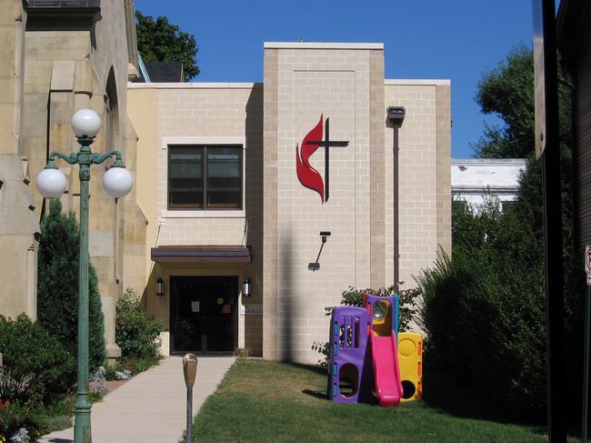
Page 259 about the 1960 dedication of Robert N. Parker Education Building mentioned in the text
Page 315 about the art gallery located in church’s basement in 1974Institute for Regional Affairs, Bucknell University. “Historic Site Survey Union County Planning Commission.” June, 1976.
Location: University Archives, Bertrand Library, Bucknell University, Lewisburg, PA
Picture and short description of the architecture can be found on pages 22 and 23Kalp, Lois. “A Tour of Union County Churches” The Story of a County: Union County Sesquicentennial. 1963.
Location: University Archives, Bertrand Library, Bucknell University, Lewisburg, PA
This brochure includes a short history of the churchHistoric Union County. “Lewisburg: The Middle Years 1840-1880.” May, 2000.
Location: University Archives, Bertrand Library, Bucknell University, Lewisburg, PA
Short paragraph on the architecture of the church“Beaver Memorial United Methodist Featured in House Tour.” Lewisburg Daily Journal 1 Nov, 1985
This article features a picture and a description of the architecture
Location: University Archives, Bertrand Library, Bucknell University, Lewisburg, PA
Lewisburg. Churches. General. Box A.11,3 Shelf 5Kalp, Lois. “Lewisburg: People and Events that Shaped its History.” Union County Pennsylvania: A Celebration of History. Snyder, Charles, Ed. Lewisburg, Pa: Union County Historical Society, 2000
Location: Bertrand Library, Bucknell University, Lewisburg, PA
The Beaver Memorial Methodist Church is mentioned on page 131Strosser, Ted. “Architectural Appendix.” Union County Pennsylvania: A Celebration of History. Snyder, Charles, Ed. Lewisburg, Pa: Union County Historical Society, 2000
Location: Bertrand Library, Bucknell University, Lewisburg, PA
The church is mentioned on page 340Diodato, compiler; C. DeEtte Edgett, Florence Pyle, and Deane Clements. Lewisburg’s Historic Architecture: Two Photographic Collections. 2008.
Location: Public Library for Union County, Lewisburg PA
Appears on the following slides with brief architectural notes: Edgett 106, 107, 108; Pyle/Clements 090, 091, 092.Union County Planning Commission. “ Union County Historic Preservation Plan, 1978.” Volume I. July 8, 2003.
Location: University Archives, Bertrand Library, Bucknell University, Lewisburg PA.
Photograph and brief architectural and historical information given on pages 26-29.
The Sanborn Fire Insurance Company's primary business was appraising American homes for fire insurance. To do so, the company produced maps of thousands of American towns, including Lewisburg, Pennsylvania. The company updated its maps periodically between 1885 and 1944. A map set consists of from 4 to 20 sheets, each covering several blocks. Each parcel is mapped; if a structure exists on a parcel its footprint is drawn, together with such details as wall material, roof material, height, and the location of doors, windows, porches, and chimneys. More information on Sanborn maps is found on the Homepage of this disc, section 4B.
In the listing below, “no data” indicates that the Sanborn map for that year does not include the land parcel on which the above building is located. “Sheet 11” (for example) indicates that the parcel in question will be found on Sheet 11 of the map set for that year. The 1944 map is essentially the 1925 map with minor emendations.
1885: Sheet 4
1890: Sheet 4
1896: Sheet 4
1906: Sheet 4
1901: Sheet 4
1913: Sheet 7
1925: Sheet 2
1944*: Sheet 2No data.